Tracks
General information
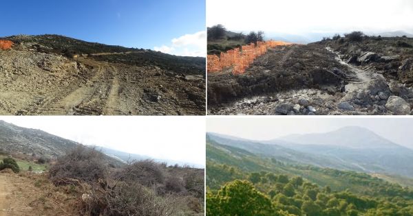
In the past, the villages of Karystia and Kavodoros in particular, communicated with paths that in some cases were paved (cobbled streets). Most of the cobbled streets belong to the era of Ottoman rul,e but there are also remnants of ancient roads, as evidenced by the placement of large stones found in some sections of paths, eg in the Roman marble quarries above Myloi or Kastri.
Many paths were lost, due to the opening of roads between villages or rural roads. With the exception of some trails still used by shepherds and a few followed by mountaineering clubs, most have been forgotten. The topographic map of Ochi mountain ("Anavasi - 2010" publications) included for the first time the basic hiking routes, but it is not always easy to walk alone because there is no signage or description. The lack of accommodation in the villages adds another difficulty, since any overnight stay must be done in a tent.
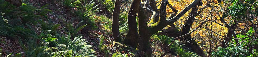
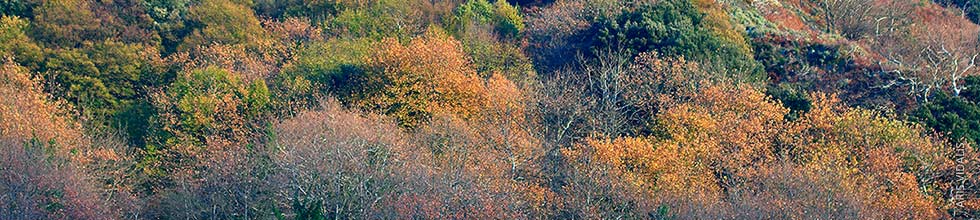
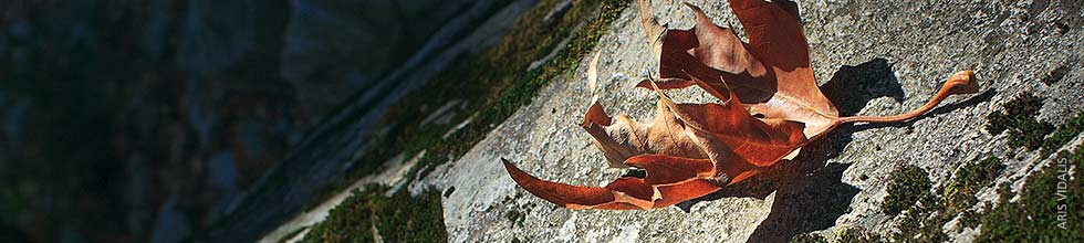
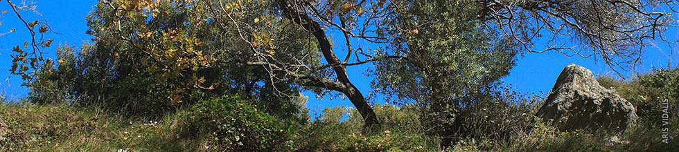
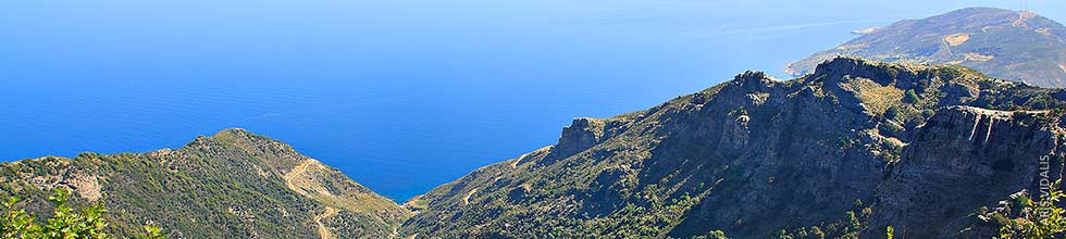
The importance of the paths, for anyone who wants to know the nature of Karystia, is invaluable. The paths are the best way to see and appreciate the unique landscapes, monuments, flora and fauna of the area. Walking on the paths, creates a closer relationship with the nature of a place. Ochi in particular, with its rapid changes in landscape, geological formations and cultural monuments, hides many unexpected surprises for the hiker. Hiking in Cavodoro has the character of exploring a place that has not yet been walked by many people.
Hiking routes
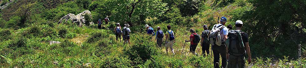
The following routes are trekking crossings, ie, the starting point and the end are different points and require one or two days of intensive hiking to be completed. Most of the individual routes can be done separately at a slower pace.
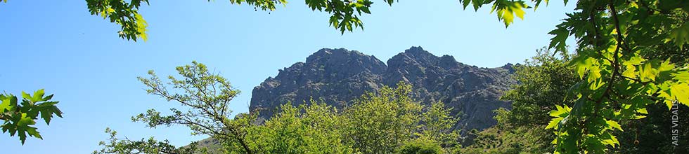
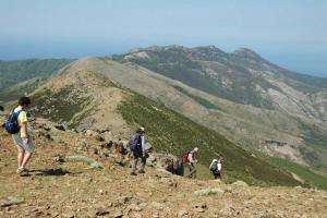
1. Two-day crossing from the Milοι to the peak of Ochi and the gorge of Dimosari
Η πιο γνωστή και δημοφιλής διάσχιση της περιοχής ιδιαίτερα στους ορειβατικούς Συλλόγους. Η διαδρομή μοιράζεται σε δύο μέρες εντατικής πορείας. Οι περισσότεροι επισκέπτες περπατούν ξεχωριστά όποιο κομμάτι της διαδρομής επιθυμούν.
This is the most famous and popular crossing of the area, especially among the mountaineering associations. The route is divided into two days of intensive course. Most visitors walk individually, whichever part of the route they wish.
- 1st day
Miloi - mountain logdge (3 hours): the path starts from the source of "Agioi Theodoroi" and ascends to the "Cylindroi" (t/n: the name means "Cylinders"). Then, it passes by "Vatouli" a site with high evergreen oaks and "Kakia Skala", where there is an impressive cobbled path. We continue until we meet the road to Kastanologo (t/n: meaning chestnut forest) that ends at the mountain lodge of Ochi (1,050m.) The mountain lodge is owned by the Giokaleio Foundation and the Federation of Excursion Clubs. It is fully equipped and offered for overnight stay only in groups, by arrangement. For details, contact the person in charge: Nikos Gikas tel. 6936365435
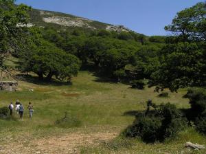
The visit to Kastanologos (t/n: chestnut forest) is one of the most intensive experiences that Ochi has to offer. It is worth wandering among the trees for many hours and admiring each tree separately. The best time to visit is spring before the herds climb the mountain.
- 2nd day
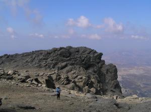
Mountain lodge - Ochi peak (1 hour): the path is marked with stones. In the eerie landscape of the peak, the church of Profitis Ilias is nestled among huge rocks. We continue a few more meters where the impressive and mysterious Drakospito (t/n: Dragon house) appears.
Ochi peak - Petrokanalos (30 minutes): steep descent at 800m. at Petrokanalos (t/n: cobbled canal), where the path of Dimosaris begins.
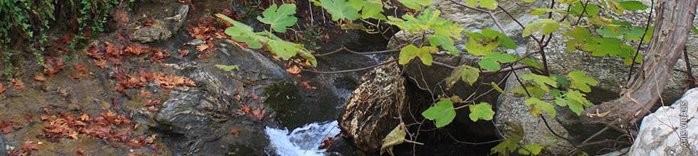
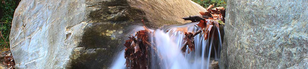
Dimosari Gorge (3 hours): a well-paved and shady path descends next to the rich waters of Dimosari. It ends at the settlement of "Lenoseoi" and from there we follow the road (1 hour) to the beach of Kallianos. The tavern Klimataria a little higher than the beach has been temporarily closed.
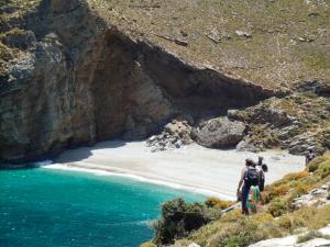
2. Gorge of Agios Dimitrios - Schinodavlia (1 to 2 hours)
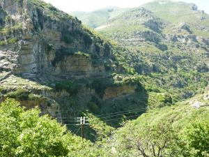
We follow the road to "Agios Dimitrios" (t/n: Saint Dimitris) and take the left fork of the road to "Kallianos". In a few meters we meet a public stone fountain from where a cement road starts and which leads to the gorge. The well-paved path goes parallel and under the vertical cliffs of the gorge. As we approach the beach of Schinodavlia, the path narrows and becomes a goat-path.
3. Agios Dimitrios gorge - Sara - Gianitsi beach (8 hours)
Coastal inaccessible route on the east coast that gives the opportunity to admire rare trees - oaks in a wild landscape. To reach "Sara", we cross the gorge of "Agios Dimitrios" and before the path begins to descend to the beach, we follow a NE uphill branch. From here the path goes parallel to the coast, but much higher. It is not always visible and becomes inaccessible in the "Sara" location, where large rocks have fallen to the shore. After about 6 hours walk, the path ends at the beach of "Giannitsi" (Limnionas).
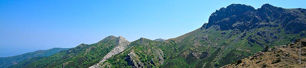
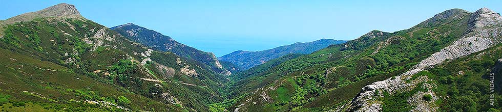
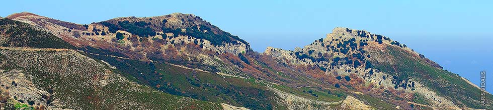
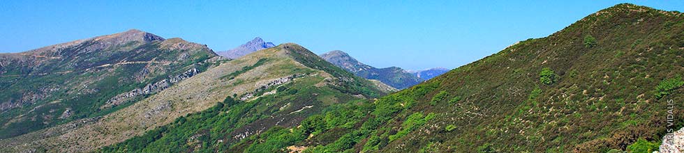
4. Two-day crossing of the mountains of Kavodoro
This route crosses the peaks east of Ochi, ie "Samari", "Kerasia" and "Anatoli" and ends at the settlement of "Gialpides". The crossing requires two days of arduous course, that compensates with the amazing view and the most beautiful mountain landscapes of Kavodoros. Alternatively, one-day hiking trails of most sections are possible. There is no signaling.
This crossing was made for the first time in 2009 by 18 people, organized by SPPENK (t.n: Society for the Protection of the Environment of South Karystia) and was dedicated to the memory of the prematurely-lost climber, Vangelis Vroutsis, who did not have a chance to walk it.
Petrokanalos - pens of Saravanos (1 hour): from "Petrokanalos" (800m.) begins a path to the foothills of "Judas" (1386m.), which ends at the pens of "Saravanos", below "Samari". The route is wonderful in spring, where you can see a lot of wild flowers.
Samari - Kerasia - Stavros Komitou (3.5 hours): from the pens we continue to the ridge of "Samari" until we reach "Kerasia". The view is panoramic. We continue east to "Stavros tou Komitou" (t/n: Cross of Komito), a saddle, where the road that connects the north with the south side of Kavodoros passes (from Kallianou to Komitos or vice versa).
Stavros Komitou - Anatoli - Anemopyla (3 hours): the path traverses the hill 1030 and passes through impressive clusters of small plane trees. Approaching the "Anatoli", we find the old chuch-icon stand of Hagia Sophia (t/n: Saint Sophia), a moving remnant of another era. We easily go up the hill in front of us, which belongs to the "Anatoli"and we find a big path where we meet another old chuch-icon stand. We continue, until we find a rural road, that we leave soon, to enter a forest with tall plane trees, while on our left, rises like a castle wall, the stone volume of the Proka complex. After a while, the stone volume stops and forms the only opening, because then, it continues with the steep cliffs of Prophitis Elias (960 m.) (t/n: Phorphe Heliah). This is the Anomopyla, a true passage of the wind from where the view of Kafireas and the northeastern side of Evia lies amazing.
Anemopyla - Gialpides (4 to 5 hours): from "Anemopyla" (t/n: Wind gate), we pass on the NE side of Proka and we start a sharp and difficult descent through a dense evergreen-oak forest to Vathirema (t/n: Deep creek). The vegetation and shade under the evergreen oaks is so dense, that it darkens. An authentic wild landscape like no other! The difficult descent ends at the chapel of Hagia Sophia, on a narrow plateau that looks like a balcony above Vathirema. From here, the path becomes more visible and ends at the settlement of Gialpides, to meet the main road that leads to "Agathos" and "Kallianou".
5. Thymi - Archampoli gorge - Amigdalia
The route "Thymi" - "Archampoli" (1.5 hours) can be completed in one day. If we want to continue for the "Amygdalia" (t/n: Almond tree) (3 hours), it is better to spend the night in tents.
Thymi is about 50 km by car from Karystos. From the first house of "Thymi", begins a downhill path, to the settlement of Arabaleika (45 minutes). We continue to the coast, where a distinct path leads to the impressive beach of Archampolis. The bay is surrounded by steep cliffs that continue along the route of the gorge, that ends at the sea. If we continue in the bed of the gorge, we will find in almost 1km, the excavation site, where a terrace with an altar was discovered. Ancient cyclopean walls are preserved higher. For the return, we follow the same route to "Thymi".
To go to Amygdalia (3 hours), we return to Arabaleika and take a path that leaves east and goes parallel to the coast. We cross the ravine of "Zacharia" and find part of an impressive old cobbled path on a cliff above the sea. After the path passes through some old estates and ends in the village of "Amygdalia". For the return, we have to go back, or have to have arranged our transport by road to "Thymi".